I was an English language arts, and social studies teacher for 20 years. The worst part of my job by far was evaluating essays. Even if we resist machine grading by AI for now, it will eventually be here to stay. And even if the AI grading isn’t perfect, we can work on our prompts to make it better and better. As a human grader/evaulator, despite my best intentions, I am certain that my essay evaluations were likely uneven. If I had 40 essays to mark, while they were hopefully fairly consistent. I’m sure there were still inconsistencies and I’m certain that I gave better feedback to some students than others.
Perhaps the most important thing to consider is that it takes a human a long time to grade 40 or 60 essays, especially if you aim to provide helpful feedback. If AI can provide reasonable and consistent and immediate feedback to our students as writers, I don’t think it is fair to ask them to wait for two weeks while a human marks a whole stack of essays to hand back at once.
Perhaps the human marks the final essay, or the final draft of the essay. In the in between, however, I think we need to consider teaching our students how to ethically use generative AI to access immediate and specific feedback about parts of their writing.
I know there are lots of other points to consider, but as a life-long English teacher, I believe AI is a path to a better way of assessing.
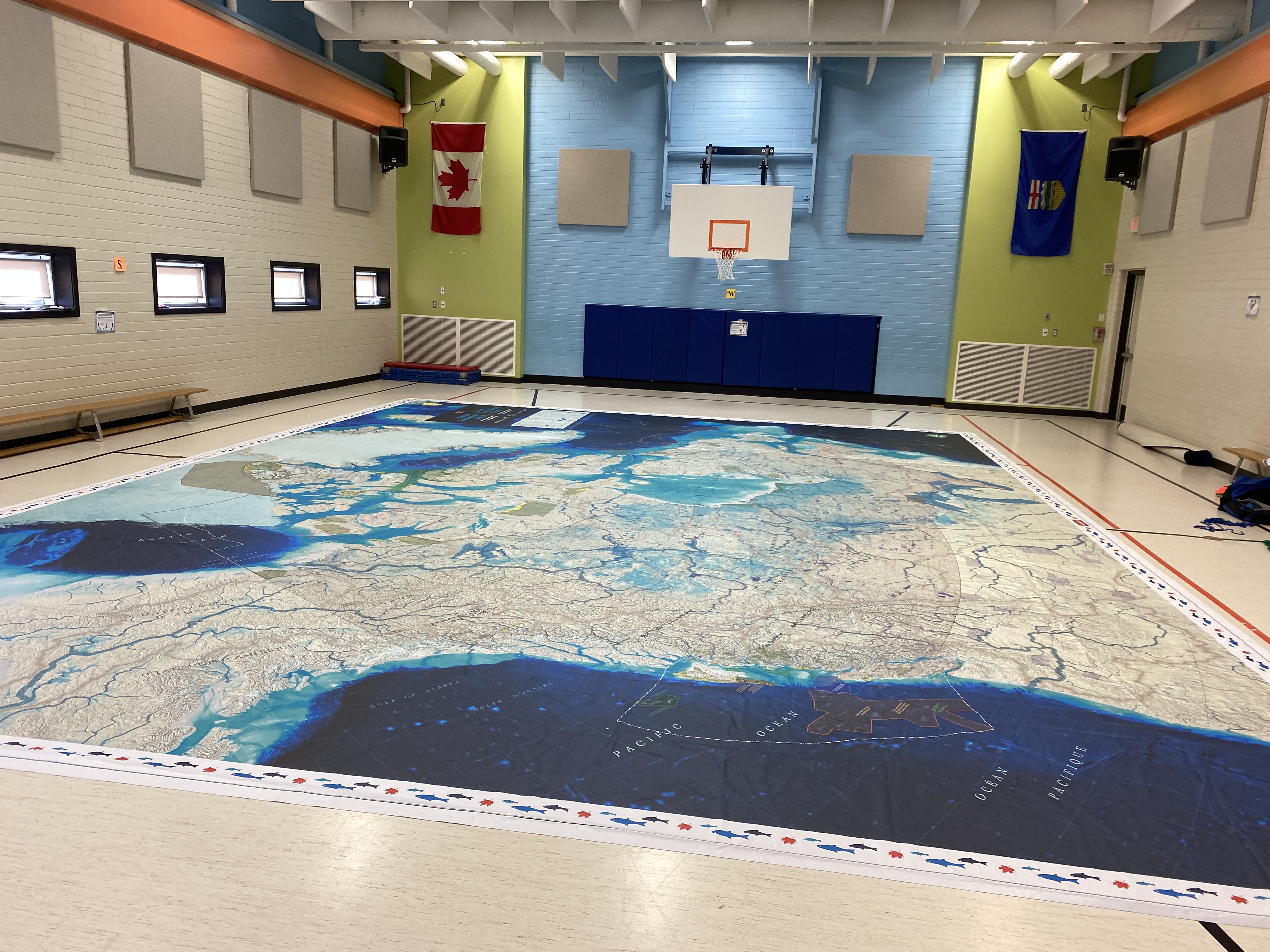
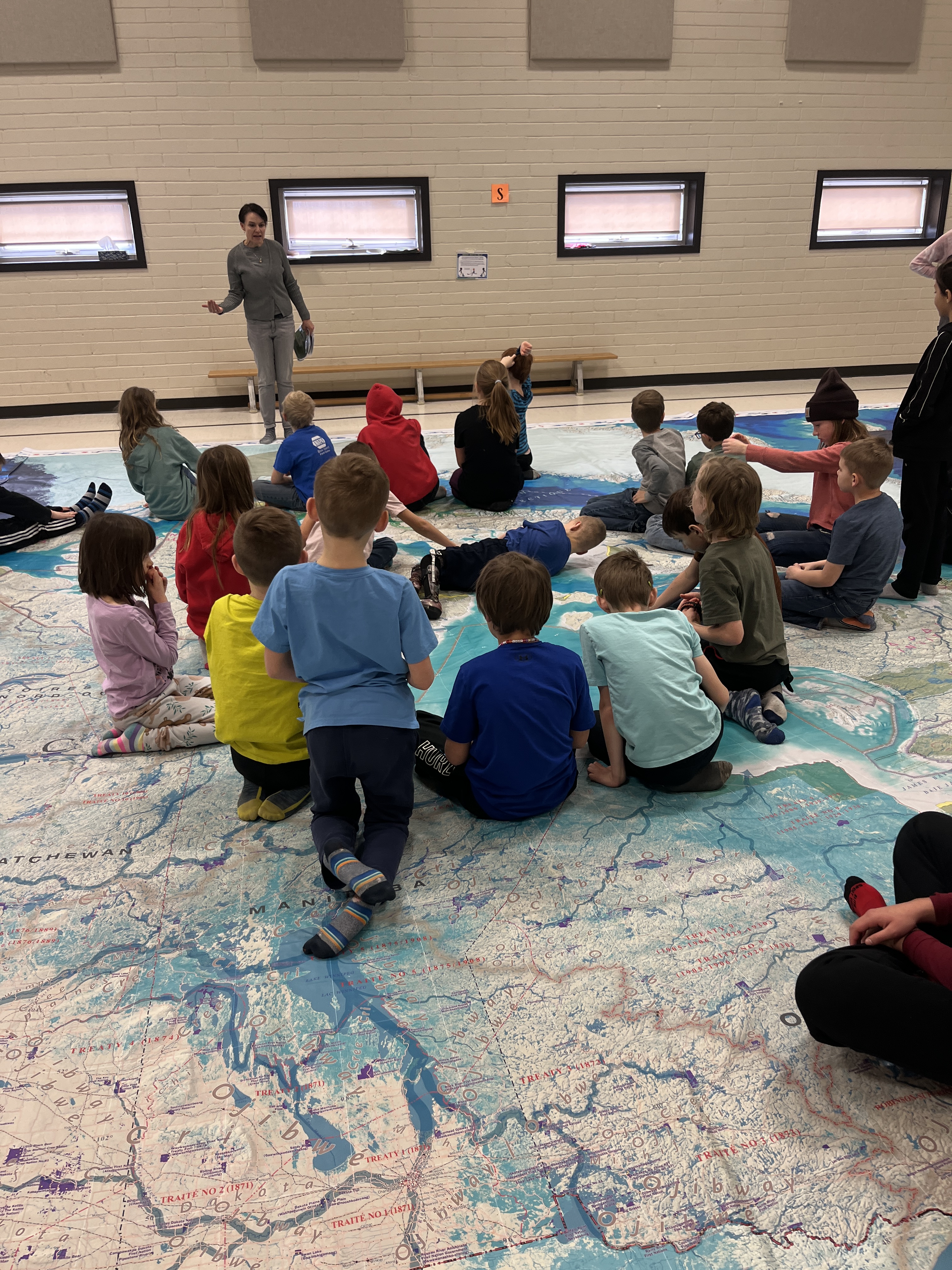
After a great Giant Map of Canada tour with over 17 stops in 2022 (read the highlights here), we decided to bring back another Giant Map of Canada from Canadian Geographic.
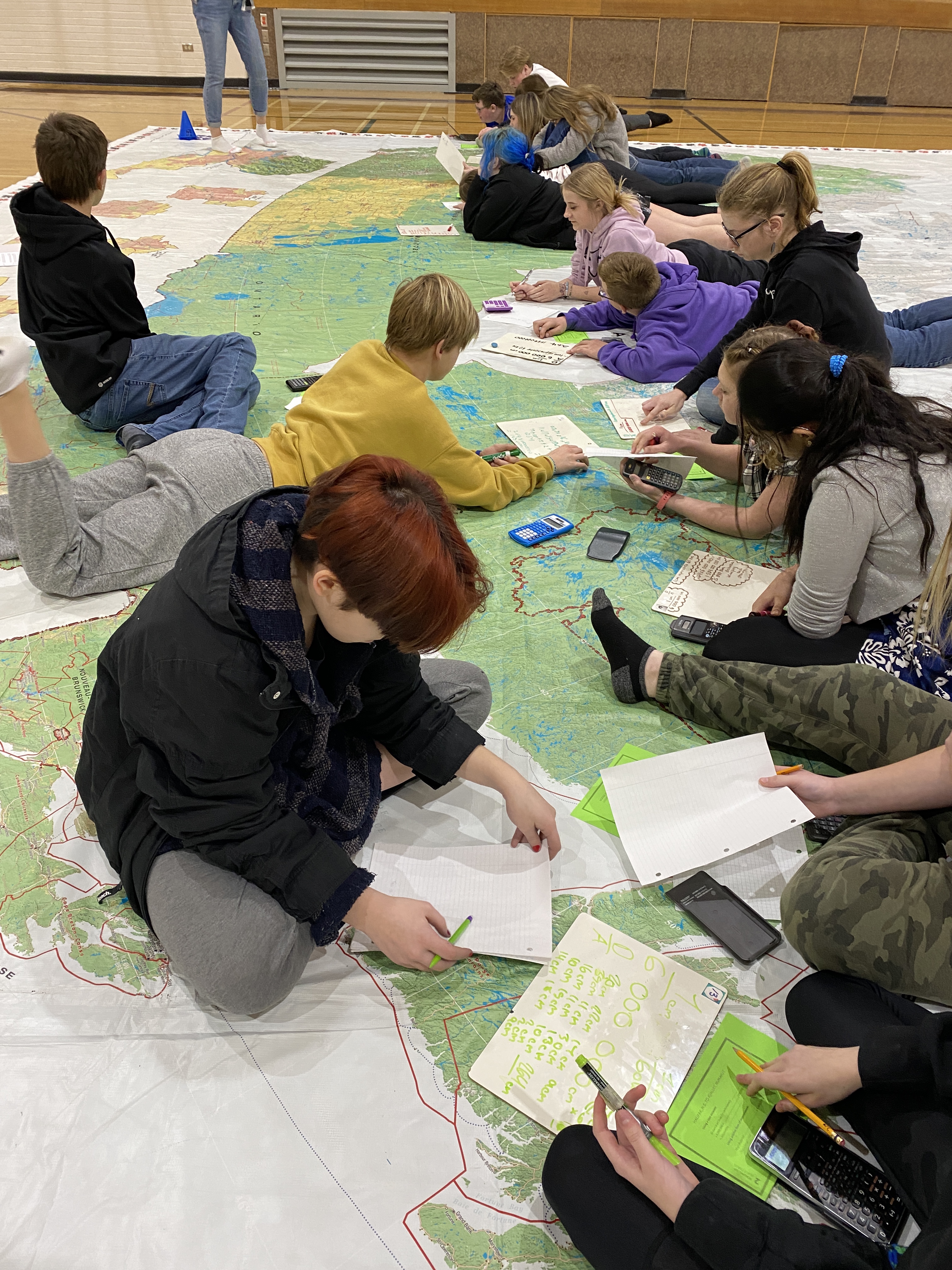
Last year we had a political map featuring Canada’s 338 electoral districts. We did many activities beyond politics of course, so I knew that any other map would be equally as versatile. This year we have one of the brand new “Oceans, Freshwater, and Us” Maps – released just this year.
Several of the schools I’ve scheduled with the map are schools that did not get a chance to experience it last year. However, the very first school we took this new version of the map to was a K-3 school where I had been last year. I was amazed at how several of these kids entered the gym and immediately noted that this was a different map than last year. Wow!
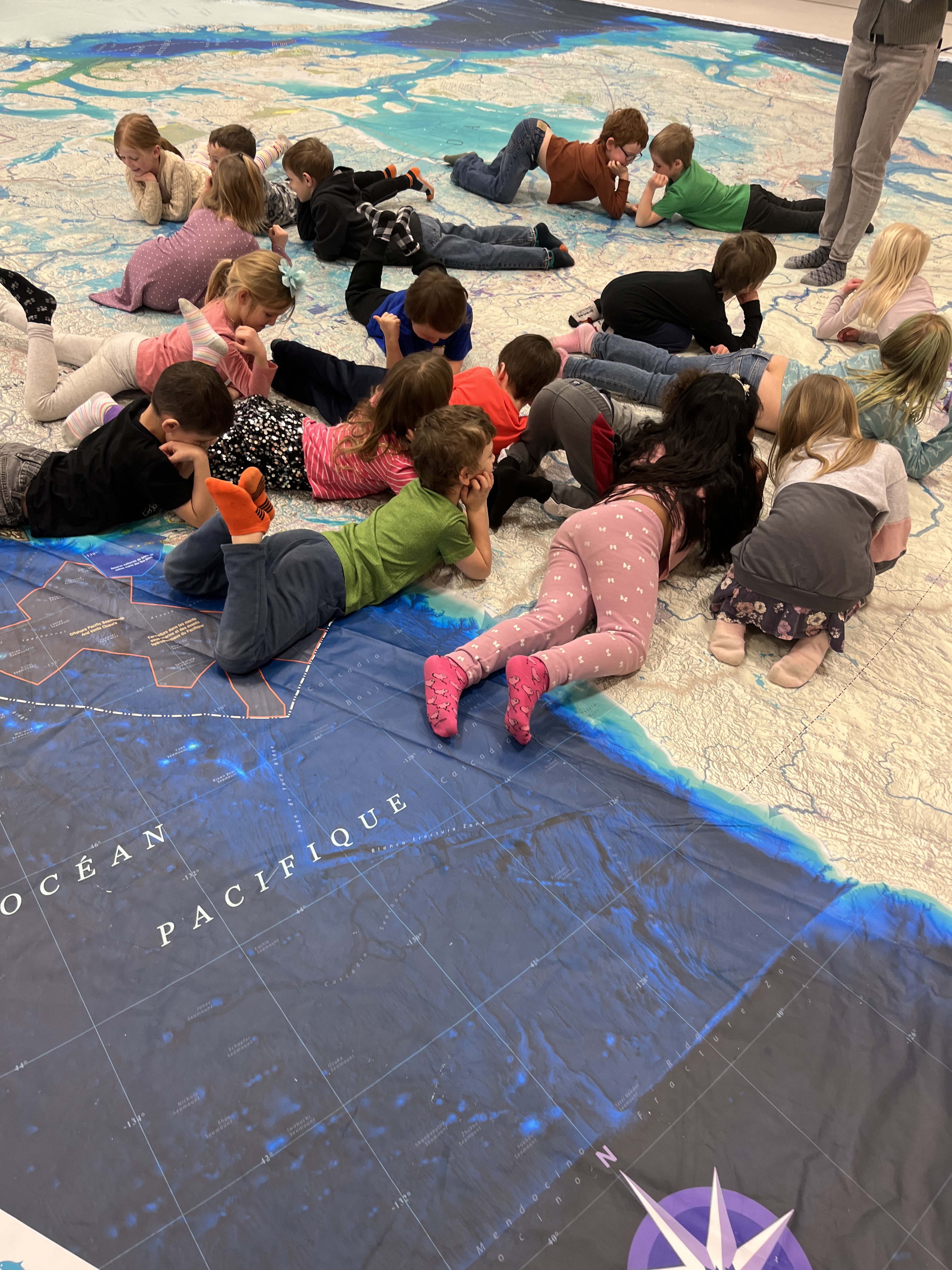
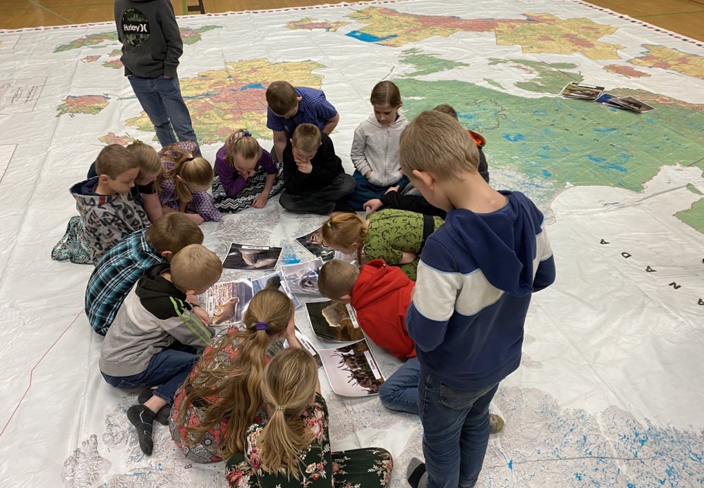
This first visit was only 30 short minutes with young learners. I learned lots from my experiences last year, so I did not go into this day with elaborate plans. Instead, we started each group off with “follow the leader” around the outside of the map with the prompts of “I notice” and “I wonder”. For most classes, this led to an authentic opportunity to explore many aspects of the map. I was blown away with the very first thing that a first grade students noticed, rather matter-of-factly: “that the dark blue is where the water is deeper”! Wow. Before I was on the map with students I wondered myself if we would ever get to talking about the ocean depth scale from the legend. With most other groups, students made this observation without any prompting or legend-reading!
Here are some of the other natural conversations that have flowed out of noticing and wondering…
🌎 marine protected areas… what does marine mean? what types of things might need protecting in a marine enrironment? why?
plate tectonics, volcanoes and the Ring of Fire in the Pacific Ocean
The wild ponies of Sable Island
The coordinates in the Atlantic Ocean where the Titanic sank
Iceberg Alley
Different countries that border Canada: USA, Russia, Denmark (Greenland), Iceland, and France (St. Pierre & Miquelon)
🌎 Provinces, and where students have lived or visited
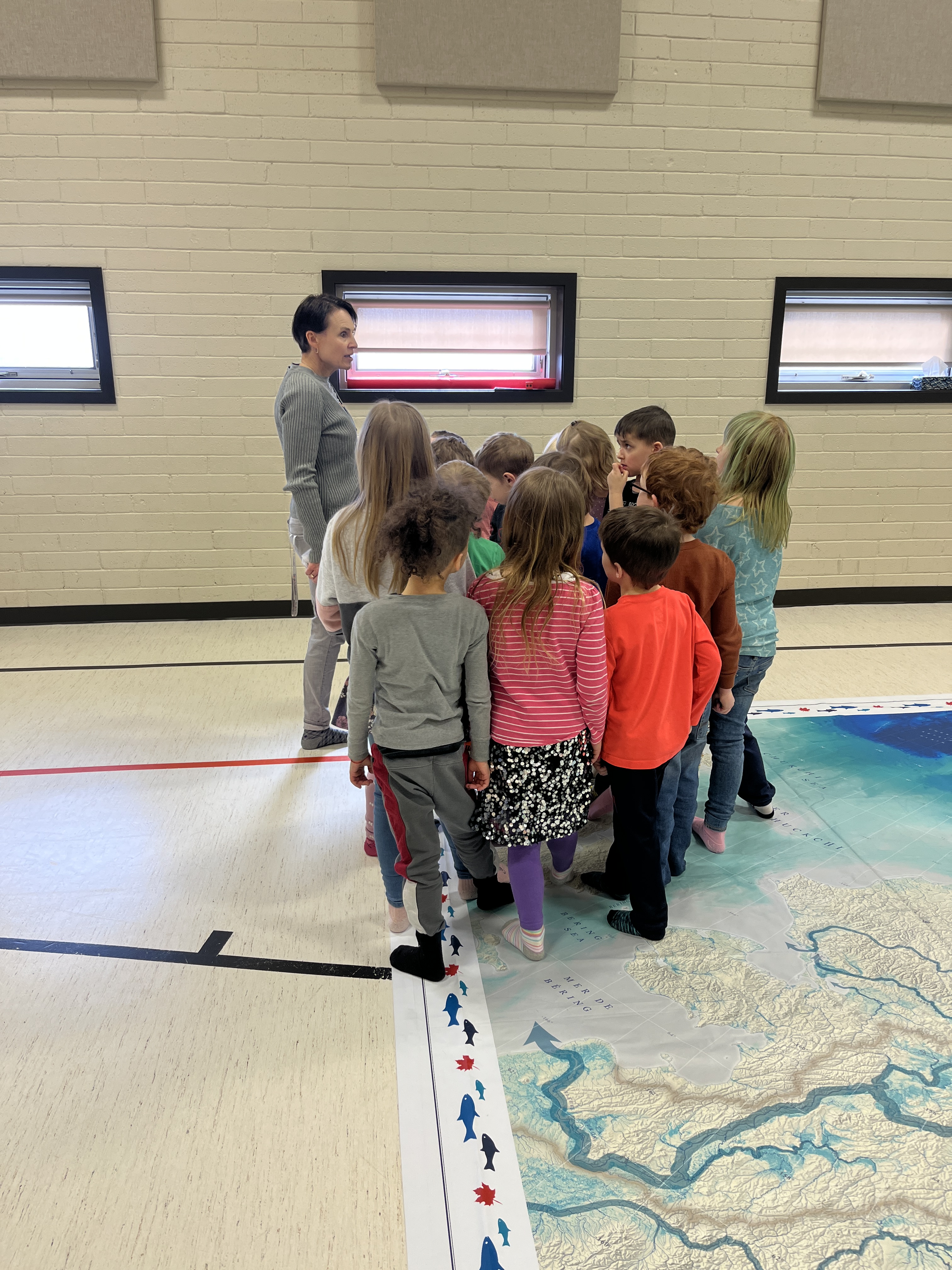
Once our wonderings and noticings wane, and students get a bit restless, I have a great activity from last #GiantMapofCanada adventure where we investigate basic map features (compass, legend, borders, river, ocean, lake, island… and for students who are bit older I add peninsuala, straight/channel and bay).
I am such a geography nerd. Maps are my happy place. This particular map has several other features that I hope will come up such as First Nations reserves and the First Nations languages.
Other lessons and conversations will hopefully occur around rivers and watersheds.
And, this map also comes with some incredible AR content! If you are interested, you can download the Canada Oceans Week App and do some wonderful exploring without even being on the map.
Plotting Voyageur route from Atlantic Ocean to Alberta
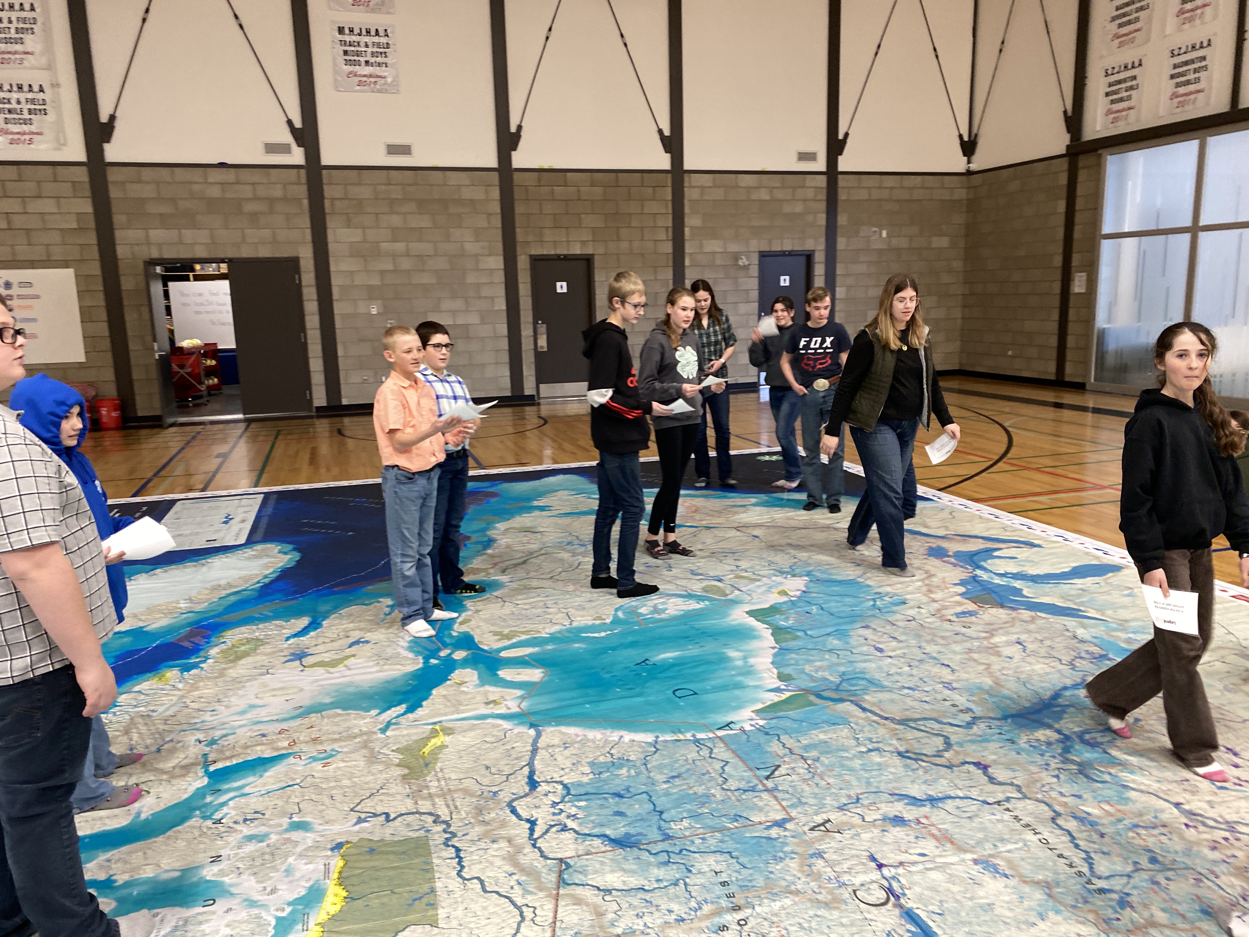
School: Irvine School; K-9 with approximately 280 students
What I learned today was that a longer period of giant map time allows for activities to be more successful. At Irvine School, the fourth-grade classes had each booked a double period and there were single time 35-minute slots with two sixth-grade classes, a fifth-grade class and a 1-2 split class.
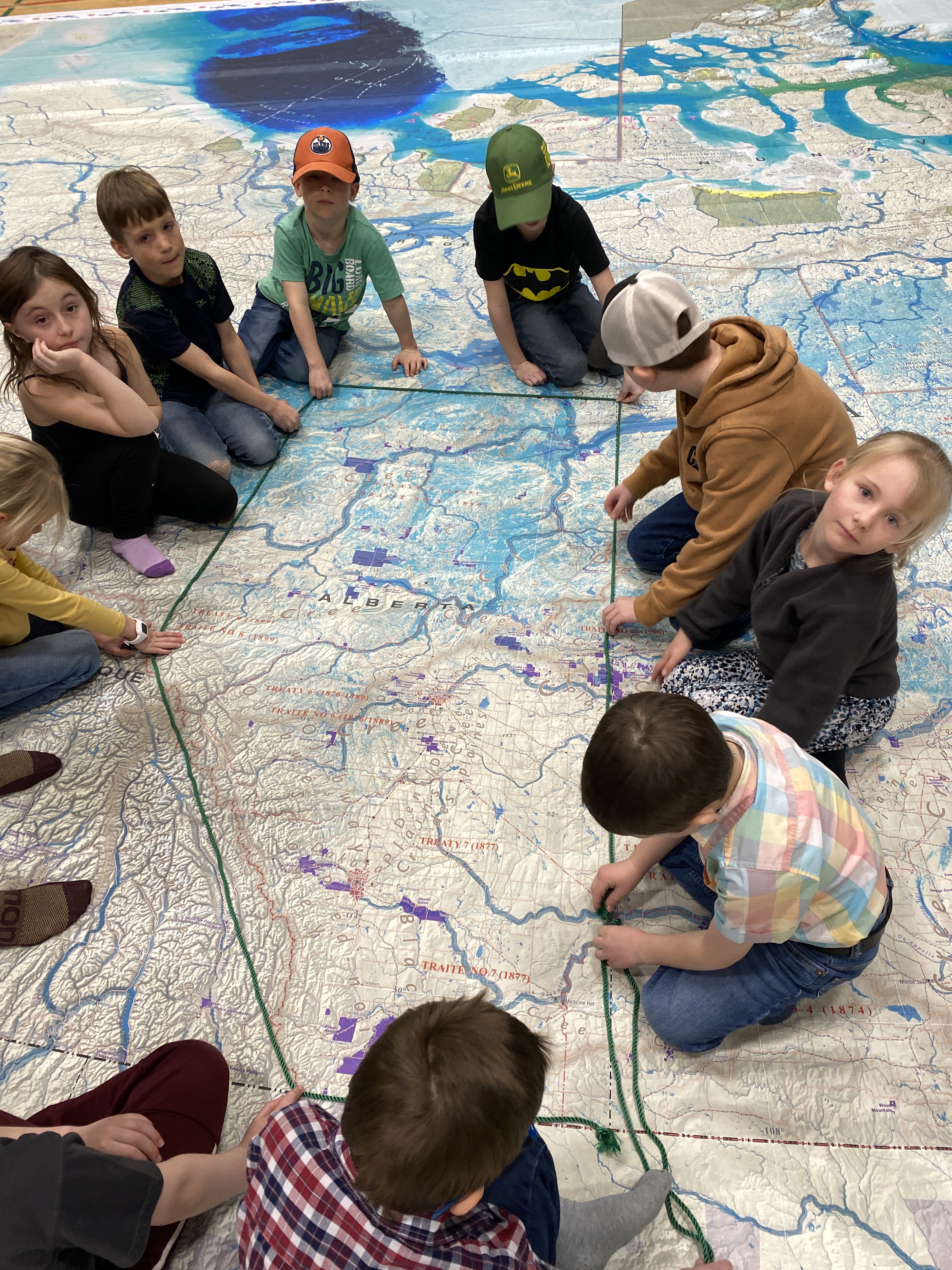
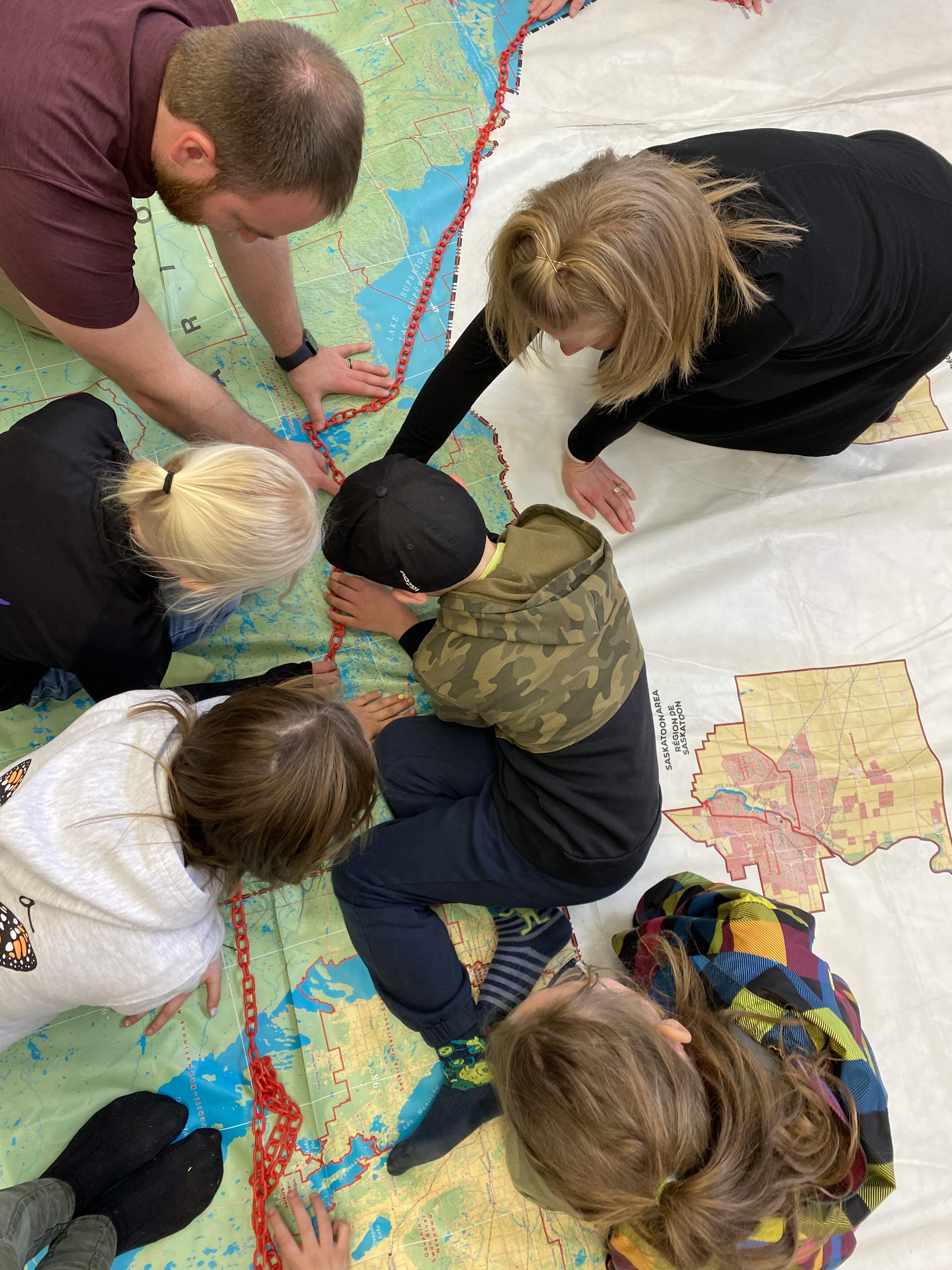
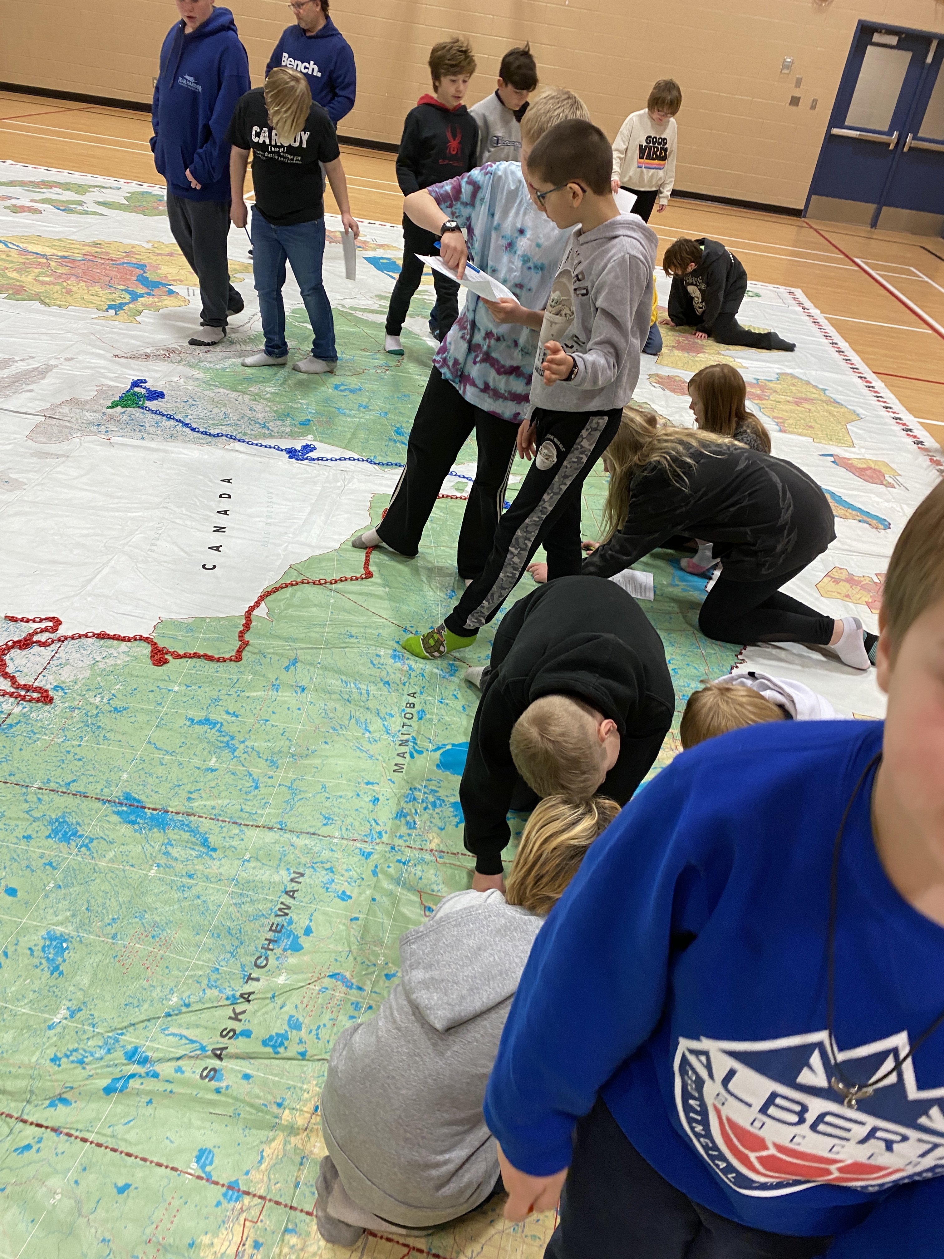
When I realized that I was getting a double period with a small grade 4 class with only 12 students present today, I knew that this would be the perfect opportunity to retry my grade four scavenger hunt/puzzle of our province, Alberta. This especially worked since this class came with the teacher, an education assistant, and a preservice teacher. We had time to do other curriculum-related activities like use the plastic chains to plot the voyageur river routes from the Atlantic to the prairies.
We started this grade four scavenger hunt activity with a mini-lesson on latitude and longitude. On this map, the latitude and longitude lines are identified by even numbers, so every second degree gets a line. The students had been introduced to latitude and longitude previously, so as they worked in pairs, usually at least one student could work out the clues. Clues relied on latitude and longitude, and two independent maps with additional locations named, such as provincial and national parks. The answers were guided by fill-in-the-letter spaces; each answer had a letter in a box that would contribute to a final word clue. The grade four Social Studies curriculum focuses on Alberta, so all clues were in Alberta.
The ultimate issue with this activity is space. With enough time, the clues are a challenge but are realistic. With 12 students in this class trying to work in the Alberta space on the map, it was tight, but JUST worked out.
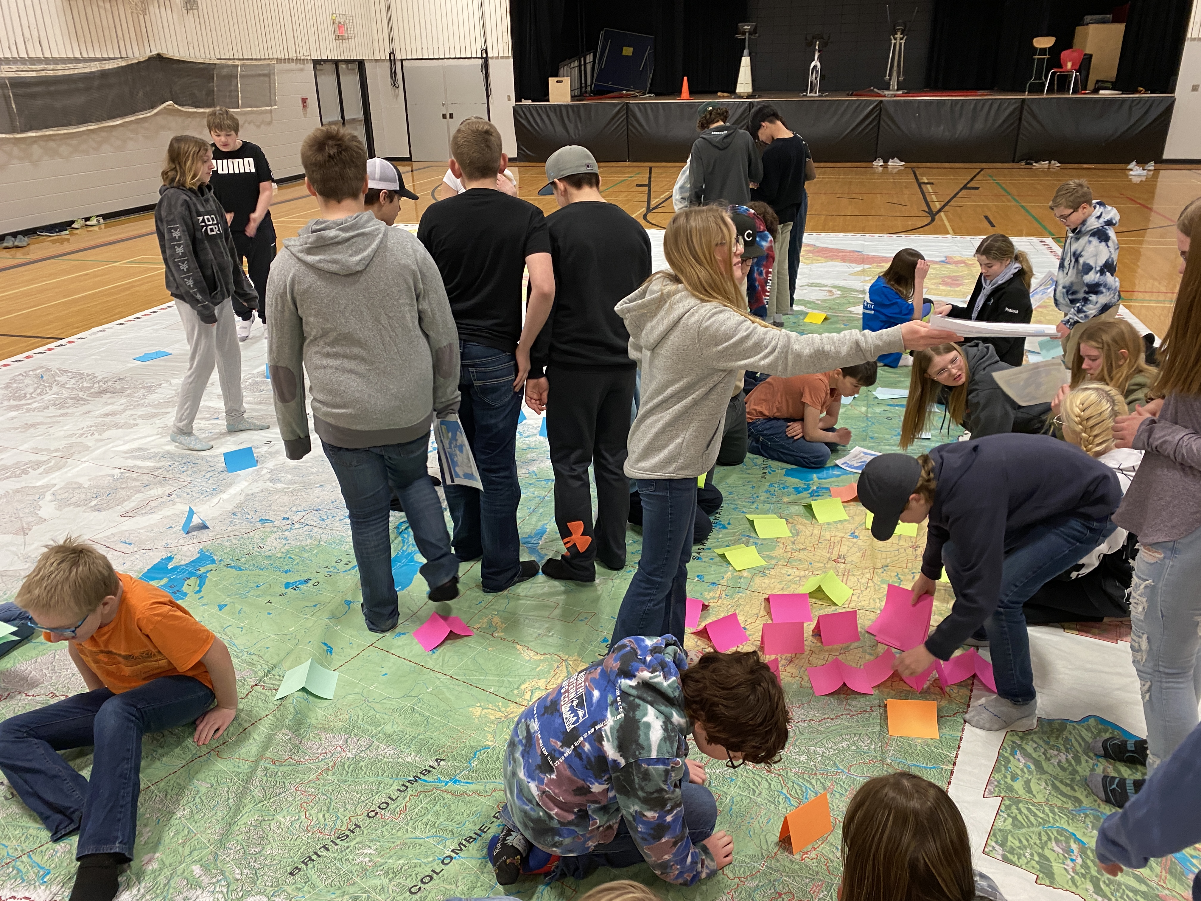
Plotting latitude and longitude locations of electricity generation in Canada
When the next grade four class came with twenty students, I knew that space-wise, the Alberta activity was not feasible. As this class also had a double period with the map, I took this opportunity to do an activity that I hadn’t yet had time to do. I have a set of about 75 ‘energy’ cards from the Natural Resources map lesson plans. Each card lists the town/city and province of an energy source, but also lists the latitude and longitude along with a picture. So after another mini-lesson on latitude and longitude, the students used the entire map to place the energy cards around the map. Each pair started with three cards. Most groups caught on quickly and were back for more cards. We placed all of the cards quite quickly but ran out of time to discuss and ask questions about patterns that emerged. This part of the lesson met my primary objective: practice identifying latitude and longitude as well as identifying the location of provinces.
The federal riding of Nunavut – 1 Member of Parliament representing approximately 40 000 people
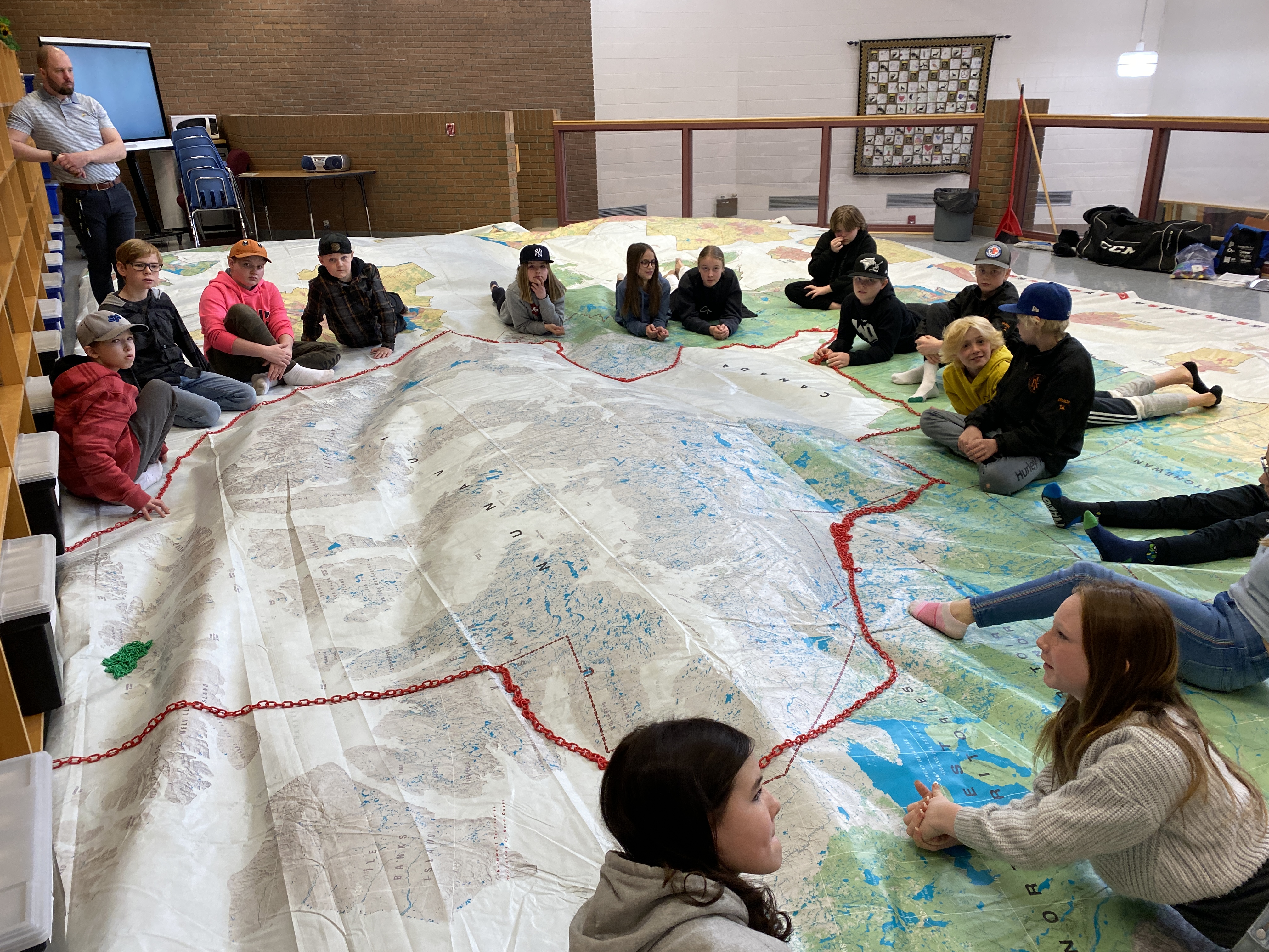
Sixth grade is the real sweet spot for this map as the Social Studies curriculum covers representative democracy. Even though the curriculum focuses on municipal and provincial levels of government, many teachers also touch on the federal level of government terms. Both our provincial and federal levels of government are elected by representation by population, so this map, with its federal electoral district markings leads to a GREAT discussion about representation by population. Especially striking is the size of Nunavut and the fact that they get only one federal representative. Marking out the boundaries of Newfoundland (see image) is always a powerful activity so I try to work it in to most of the classes that come to visit the map.
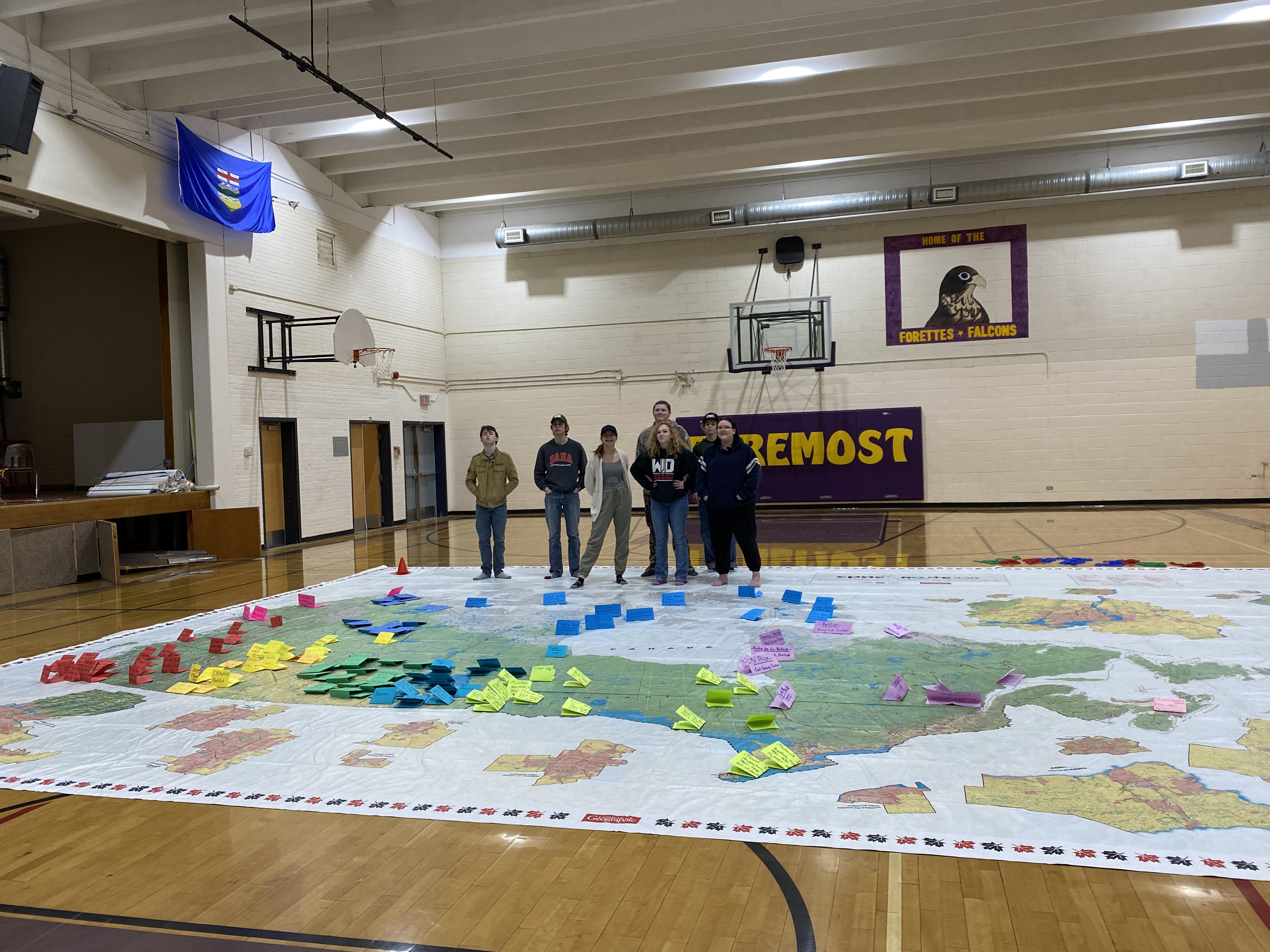
Day 4 saw the Giant Canada Floor map with Junior High classes at South Central High School. I found out the night before that all classes chose to do a Residential School lesson; this was a bit of a surprise but doing the same lesson repeatedly does simplify planning.
With class sizes varying from about 14 to 35, the tone of each lesson was certainly different. We started by asking what students knew about about residential schools. There were a few students in each class who knew some parts. I filled in details to create an atmosphere fitting for the seriousness of the subject matter.
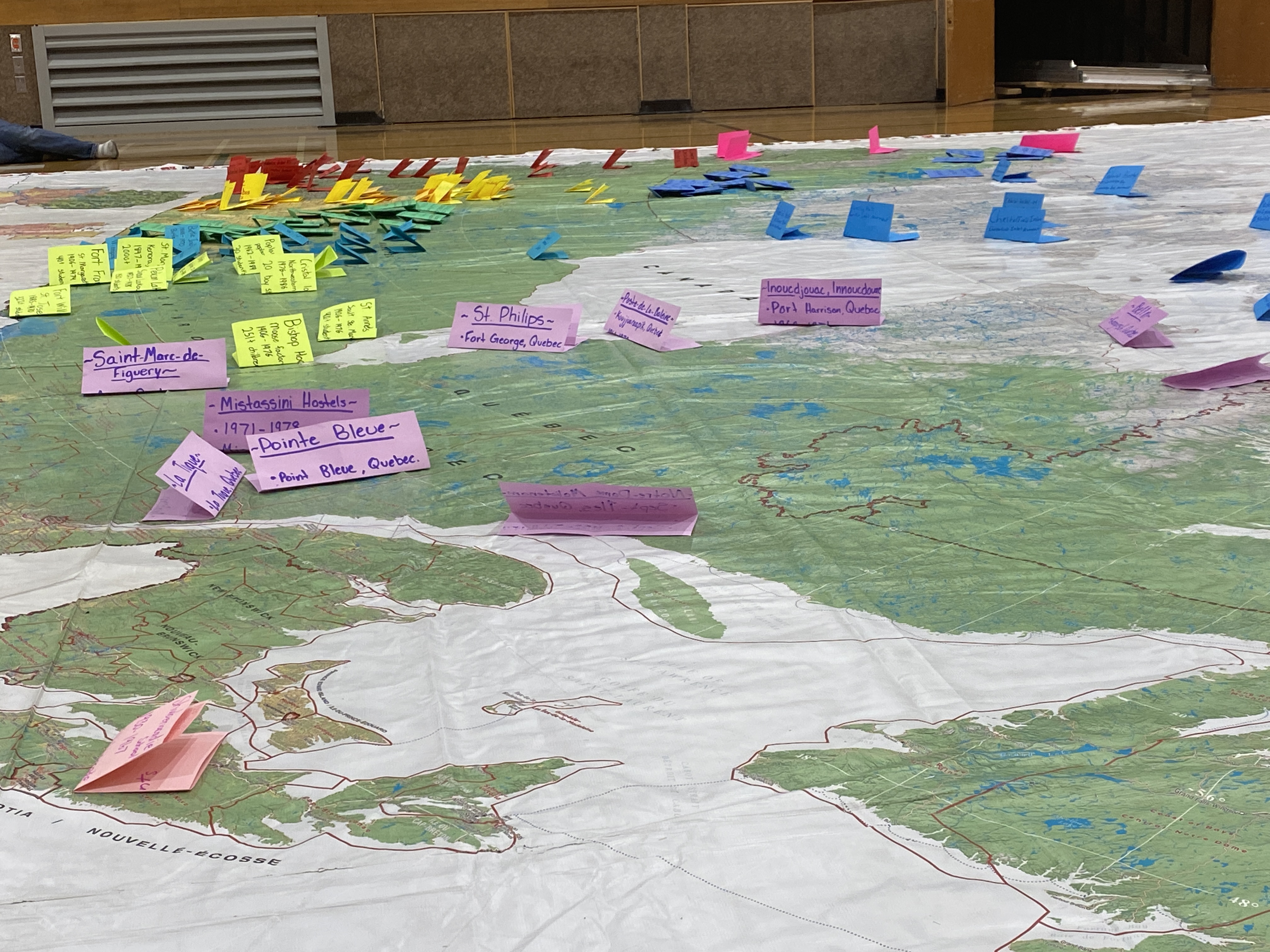
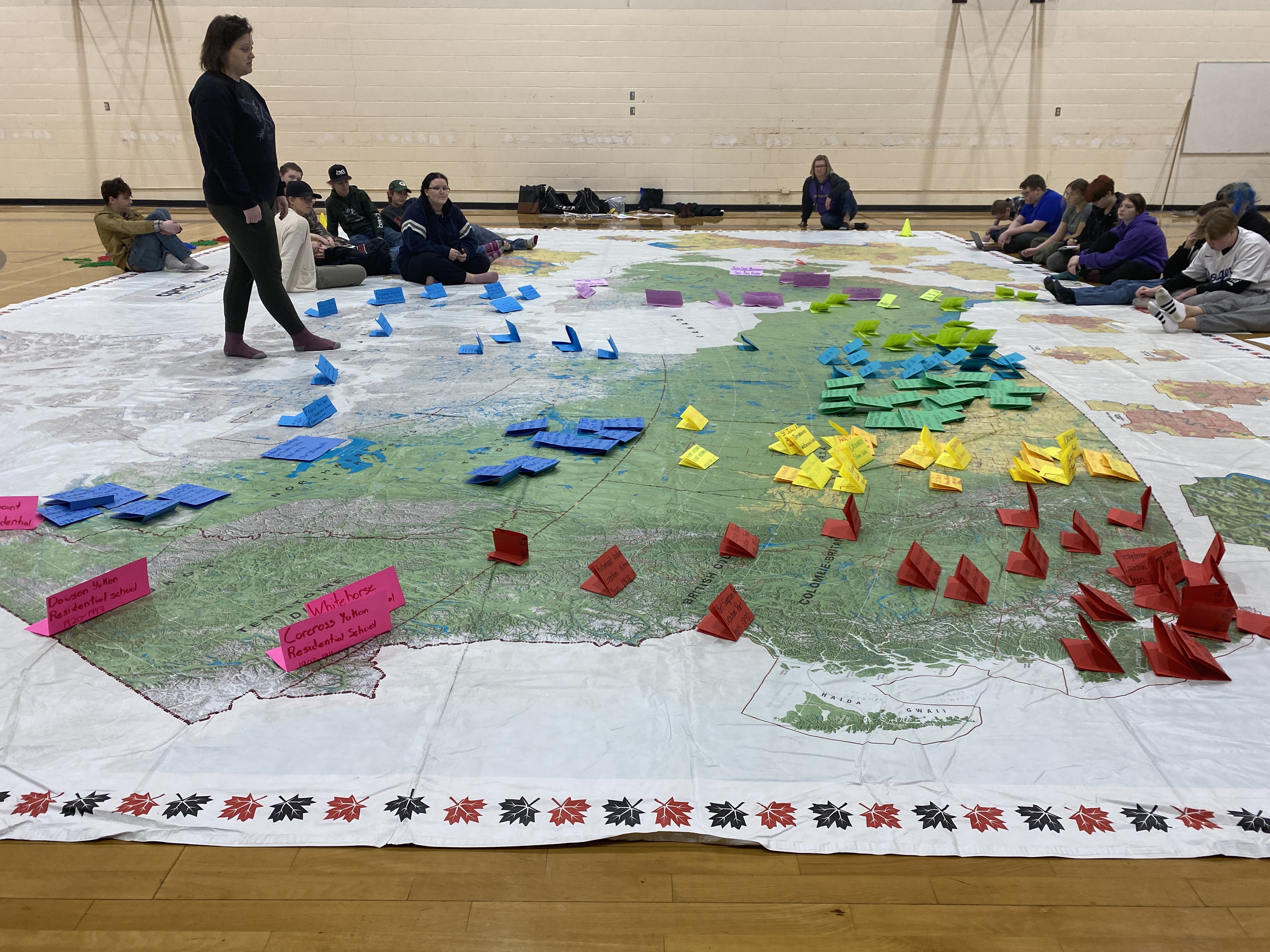
Each class then got divided into 8 groups; each group got a stack of uniquely coloured paper (thanks to Angela Hazell at Foremost School for this idea) and a map of all the residential schools that have existed in Canada. Working in their groups, students were asked to place a tent-like folded piece of paper to represent every residential school in their assigned region. We finish off by asking a student or teacher to place the single sheet of paper in the Atlantic region.
We then have the groups sit back and take in the creation. This is a powerful visual. Every time.
I read a section from the 1894 Indian Act that explains what happens to parents who don’t send their students to residential schools (fine or imprisonment). Students are asked to think of an “I notice…” statement, or and “I wonder….”. Observations and questions were quite similar:
the West has more residential schools
Alberta has the most residential schools
why does the Atlantic region have only one?
surprise at the number of schools in the north
schools in the Arctic are all located next to the ocean
how were they able to build schools so far up north in the Arctic
We discussed reasons and answers as much as time would allow. Check out this site for info about the history of residential schools around Canada.
This activity is impactful, even without the Indigenous Peoples themed floor map.
Grade 5 groups work on the “Amazing Race” scavenger hunt
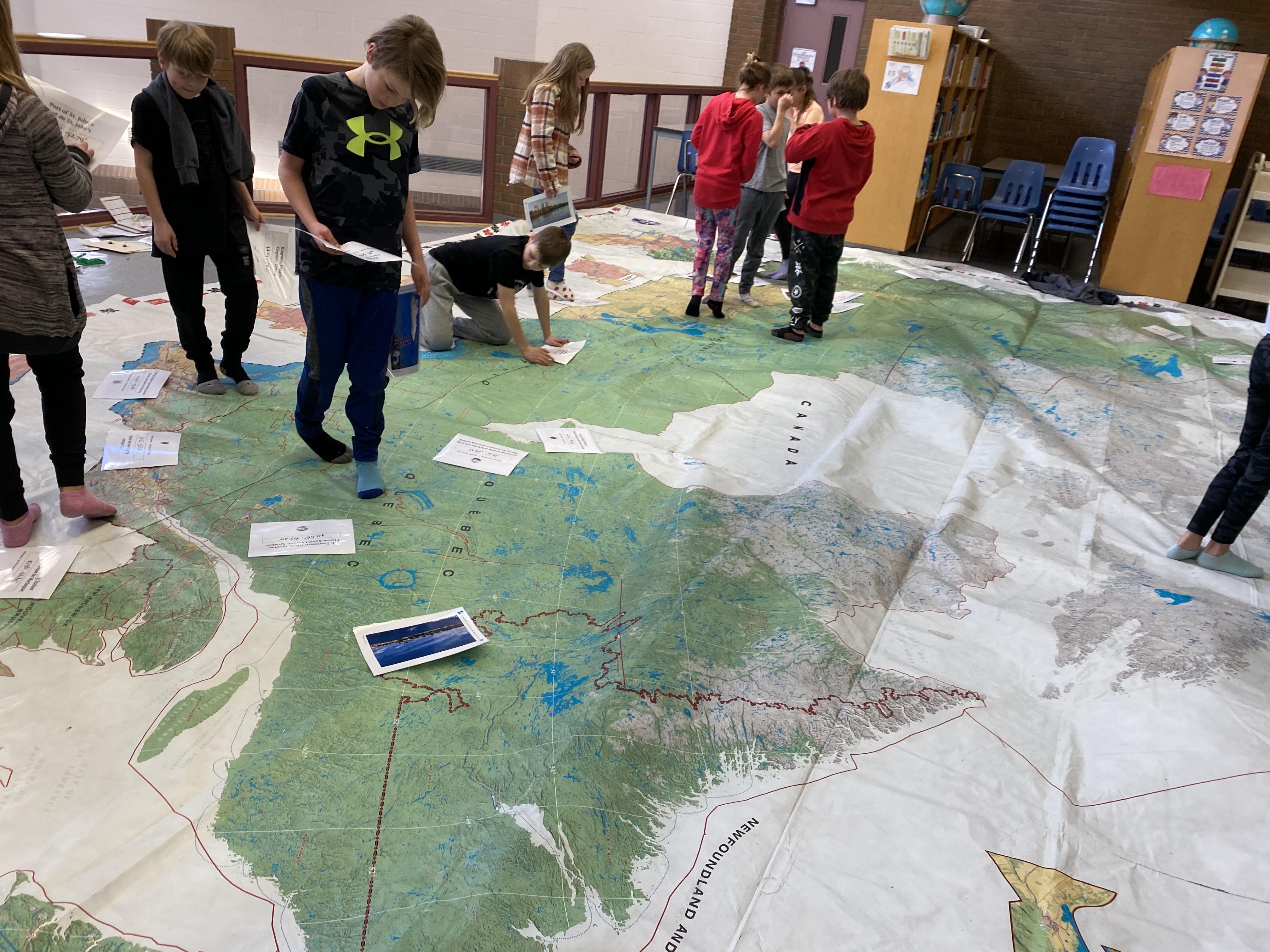
Day 3 was at Margaret Wooding School, a grade 4-6 school with several classes at each grade. Initially, I had distinct activities planned for each grade that matched the curriculum. Grade 4 would focus on Alberta, grade 5 a Canada scavenger hunt and grade 6 would focus on the political features of the map which shows all of the 338 electoral districts in Canada.
For each group we started out with some activities with very basic map features. After the first group, I realized that we also needed to do a focus on the provinces before anything else.
The Not-Quites
With the first grade four class, I tried a modified version of the grade four “Alberta mystery word” activity that I had planned. The activity involved some latitude and longitude which they were not familiar with, so after a brief mini-lesson, I had the teacher be the “recorder” as I led the class through the clues. In this case, there were too many students to fit around the “Alberta” part of the map so attention wandered and although we did a few questions together, we did not have time to solve all the clues to find the mystery word. I did not even try this activity with the grade fours again! It would likely work nicely as an activity with students and individual maps as a way to practice latitude and longitude.
For the first grade five group, I tried the “Amazing Race” game which I had reconfigured after Day 2. I gave each group of two or three students a paper version of a Canadian Scavenger hunt; each group had a different number circled as a starting point in order to keep students spread out. We reviewed basic geography, including N-W-S-E directions and started the quest -but I forgot to do a review of provinces. Thus, it quickly became clear – as students were wandering around the Yukon looking for Ontario – that this was once again still not quite right! I did let the students continue until our time was up, just to see how things would turn out. Some groups got four or five of the questions answered, although not always correctly, but many groups barely found two answers. So back to the drawing board for that one, too.
The Go-To Activities
So, for the remaining five classes, whether grade four or five or six, I did a stretched-out version of basic geographic awareness. I use the physical map feature image cards that I created to lead students on a “show-me” scavenger hunt. I also made an extension pack of these images and definitions that can be used as “matching” cards or a memory game. After the “show-me” scavenger hunt, we distribute the cards and have students review the terms and features by finding their partner. I “time” the students and they compete to beat the time of the other classes. I had students use the plastic chains to show the border of Nunavut which equates to a single MP (Member of Parliament). Students are always amazed at the size of Nunavut. With the remaining five classes, I did touch on the electoral district boundaries on this map – each one equalling approximately 100 000 people – as part of the basic geography chat. This seems to be a safe go-to as a topic.
Realizations
I can’t assume that students in upper elementary school know the provinces of Canada. Of course, this can vary based on current or previous teachers’ passion for Canadian geography.
On Day 2 of the giant Canada floor map in Prairie Rose, the map travelled to Foremost, Alberta. This is our only K-12 school, so it is not surprising that it had booked the greatest age range of student experiences.
The version of the map that we have is the Canadian Political map that shows all 338 electoral districts in Canada. The larger-scale city insets that are around the edges of the map do cause a bit of confusion for the younger students who struggle to differentiate between the actual Canada and the insets. Fortunately, they kind of look like puzzle pieces, so during certain activities, I can tell the littles that have to find “x” that isn’t on “a puzzle”.
One of the reasons that I chose this map was that it had distinct provincial borders and also showed some physical features such as forests, agricultural land and barren or snowy land. This makes this map quite versatile and so I drew from the online lesson plans that were available from other giant maps on the website at Canadian Geographic Education. In addition, I’ve created some of my own lesson plans.
Biggest Impact
So even though we didn’t have the Indigenous Peoples Atlas Map, I still wanted to be able to offer Indigenous-themed lessons if that was what teachers wanted. This was the case with the only tenth-grade teacher in the district to book a map session -she wanted a lesson related to residential schools. To prepare for this session, the teacher, Mrs. Hazell, had her students research every residential school that existed in Canada and make an info card for it. The residential schools from each province were on separate colours of paper. The info cards seemed a bit large when it came time to place them on the map, so we folded them into quarters – this actually had a great effect as it gave the information a 3-D look which was more impactful.
Even though Mrs. Hazell and I have been teaching students about residential schools for a decade and a half, the impact of this activity was still intense. The visual locations of the schools led to great discussions about history and geography and settlement patterns. We needed more time for this one!
Needs Just a Bit of Tweaking
The last class of the day was a request for a Junior High MATH lesson. For this lesson, I used a lesson activity from the Natural Resouces Map. This was a very active lesson where we got out tape measures and crawled around on the map measuring the “highway” distance between two locations. Mrs. Cooper then gave a review lesson on proportion: the scale of this map is 1:6 000 000.
Biggest Improvement
The biggest improvement for today was that I discovered the plastic “chains” and pylons that come with the map. The chains helped to highlight parts of the map for the little kids. We “chained” borders around Alberta and Nunavut several times today.
This chained border around Nunavut was particularly impactful with students in grade 5 and above as we talked about how the purpose of the map “insets” or “pop-outs” was to better show the number of Members of Parliament in a region. Although I talked a fair bit with the grade 5 and 6s about MPs, we didn’t do the actual representation by population activity as they have not yet covered that part of the grade 6 curriculum. At any rate, Nunavut is huge, and it only has a single MP. (Calgary has 10, Toronto has 25.)
Biggest Flop
The biggest flop of the day was with this same grade 5 and 6 class. We attempted to play an Amazing Race type Canada-quiz game. I followed the suggestions in a lesson from the Natural Resouces Map, (modified for the locations visible on this map.) This was not a huge success. 4 groups of students are supposed to listen to a clue and then try and figure out the answer (using legend, scale, knowledge of provinces, etc) and be the first to place their pylon on the correct response. A few issues that I need to resolve:
Students are weak listeners and are used to “seeing” instructions; the verbal clues (as suggested in the lessons plan) were very difficult for them to follow. I realized this after the first clue and gave each group whiteboards and markers, but discerning what keywords to write down was also difficult.
Being the “first” to place their pylon also had issues. What if they were incorrect? I thought that I would wait for each clue until all groups had placed a pylon, but that took too long. Many of the clues were location A or B… this resulted in big clusters of kids around the locations — trouble!
Solution?: Maybe give each group a list with all of the clues? Then they write their answers on the papers and the group that gets the most correct answers after X minutes is the victor? This would solve the “listening” issue! They could do clues in any order which would help with the congestion; or maybe we indicate a “shotgun” start like in golf?? This might be a good strategy for Monday at Margaret Wooding School, when there will be multiple grades of classes to visit the map. 3 classes of 12 groups each… Hmmmm, that’s a contest!
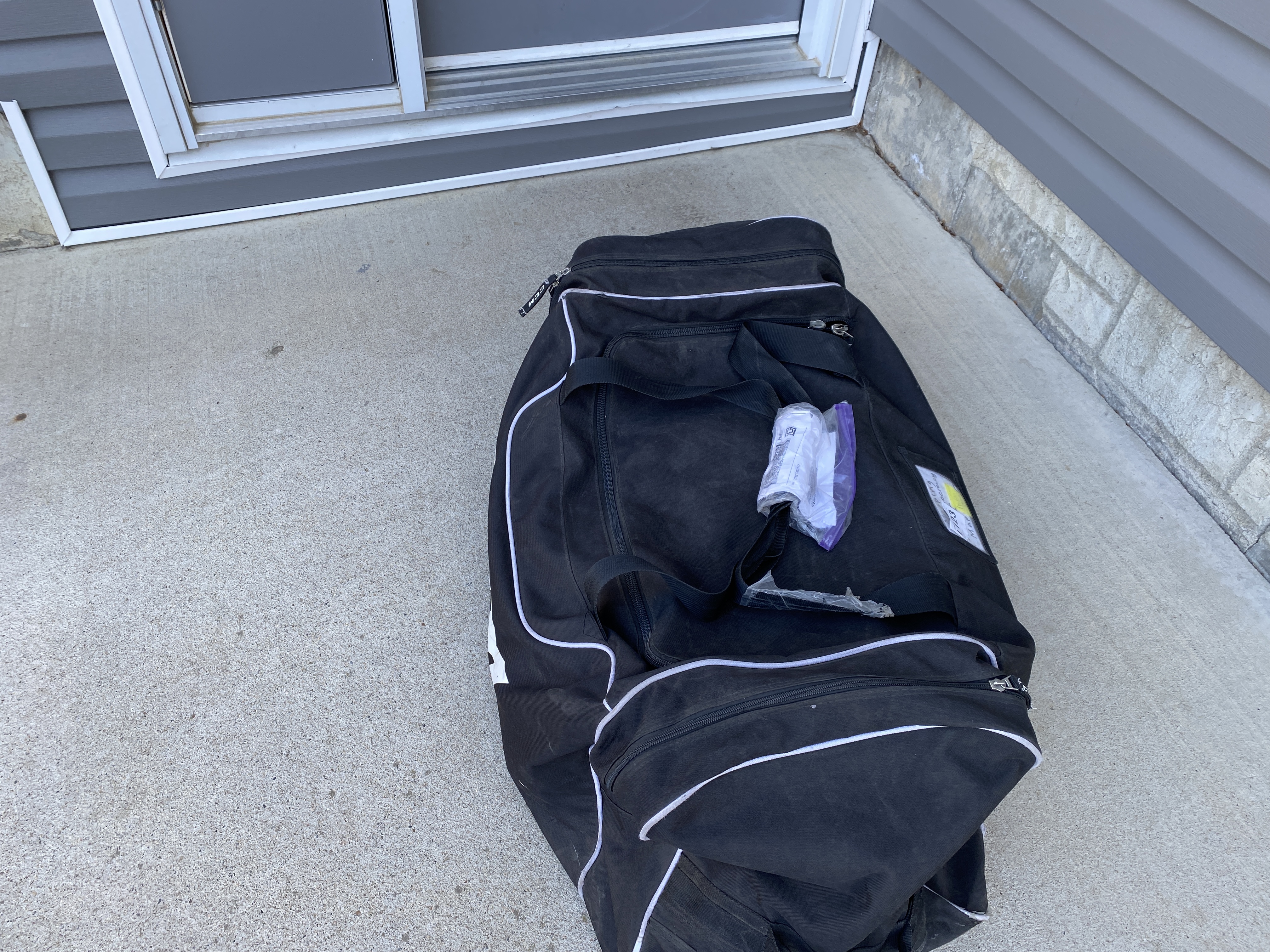
It has finally arrived! After an unexpected and disappointing delay of several days, the giant floor map of Canada arrived at approximately noon. I was relieved because that gave me just enough time to get to this afternoon’s originally scheduled Giant Floor Map experience at Prairie Mennonite Alternative School, just a few minutes drive from my house.
Hypothetically, the map was supposed to be delivered to our district office, but when the shipping/tracking updates unexpectedly came through with my home address, I knew I had to stick close to await the arrival. Fortunately, delivery was smooth.
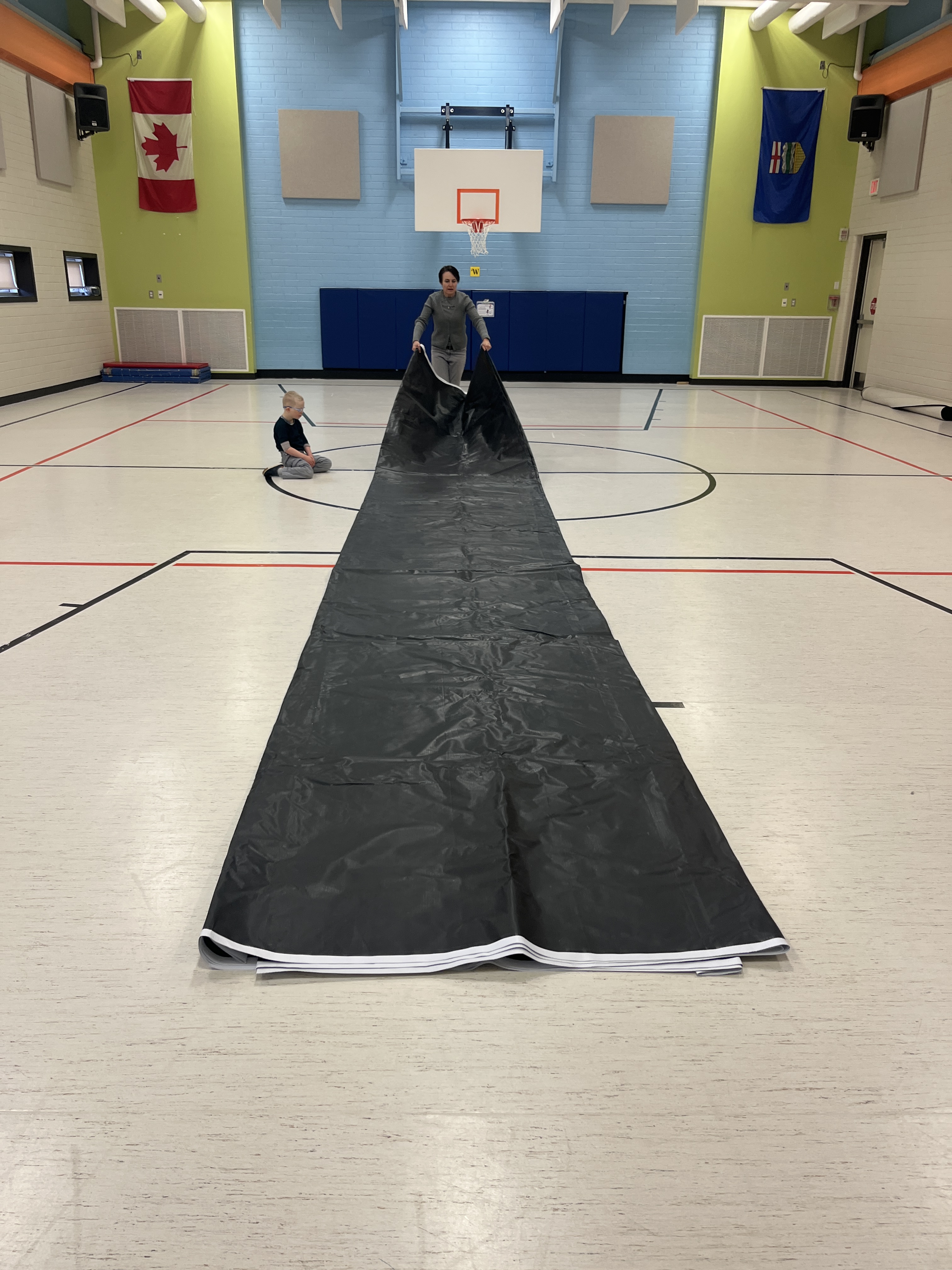
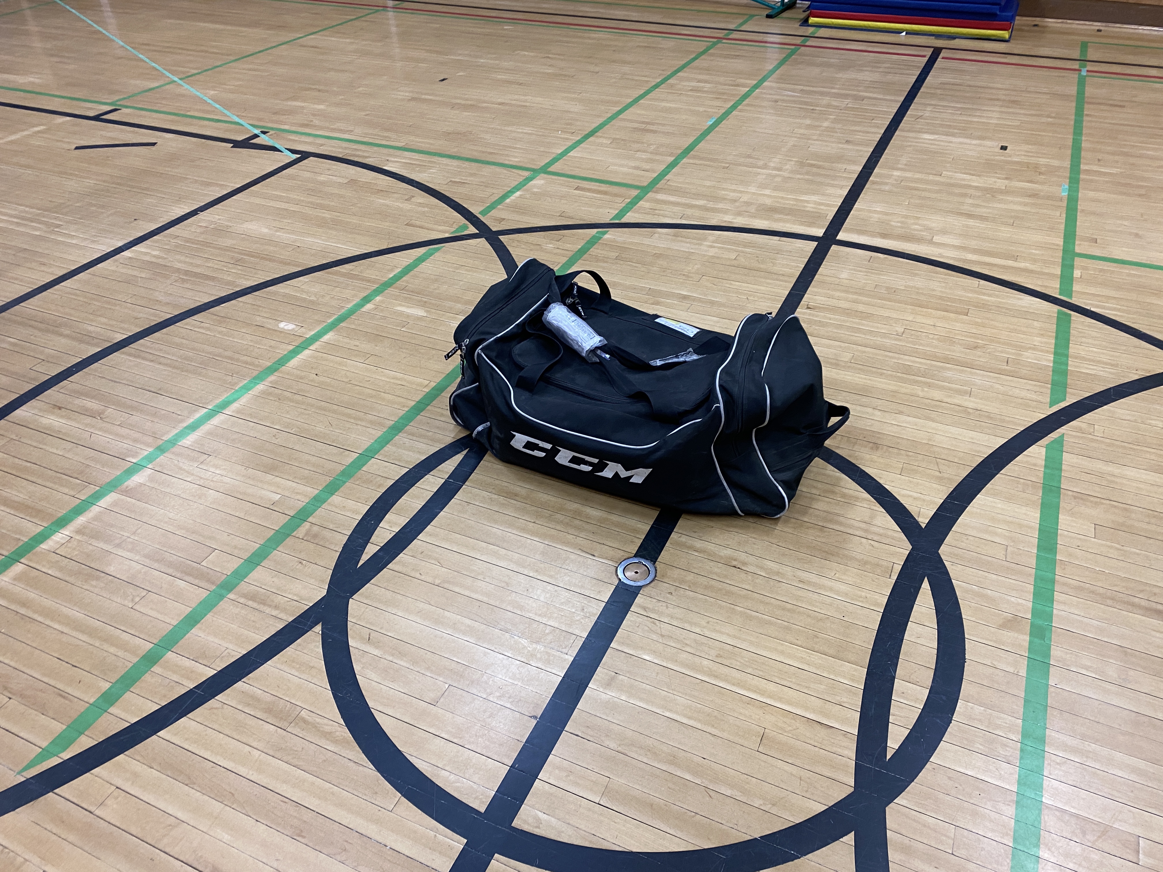
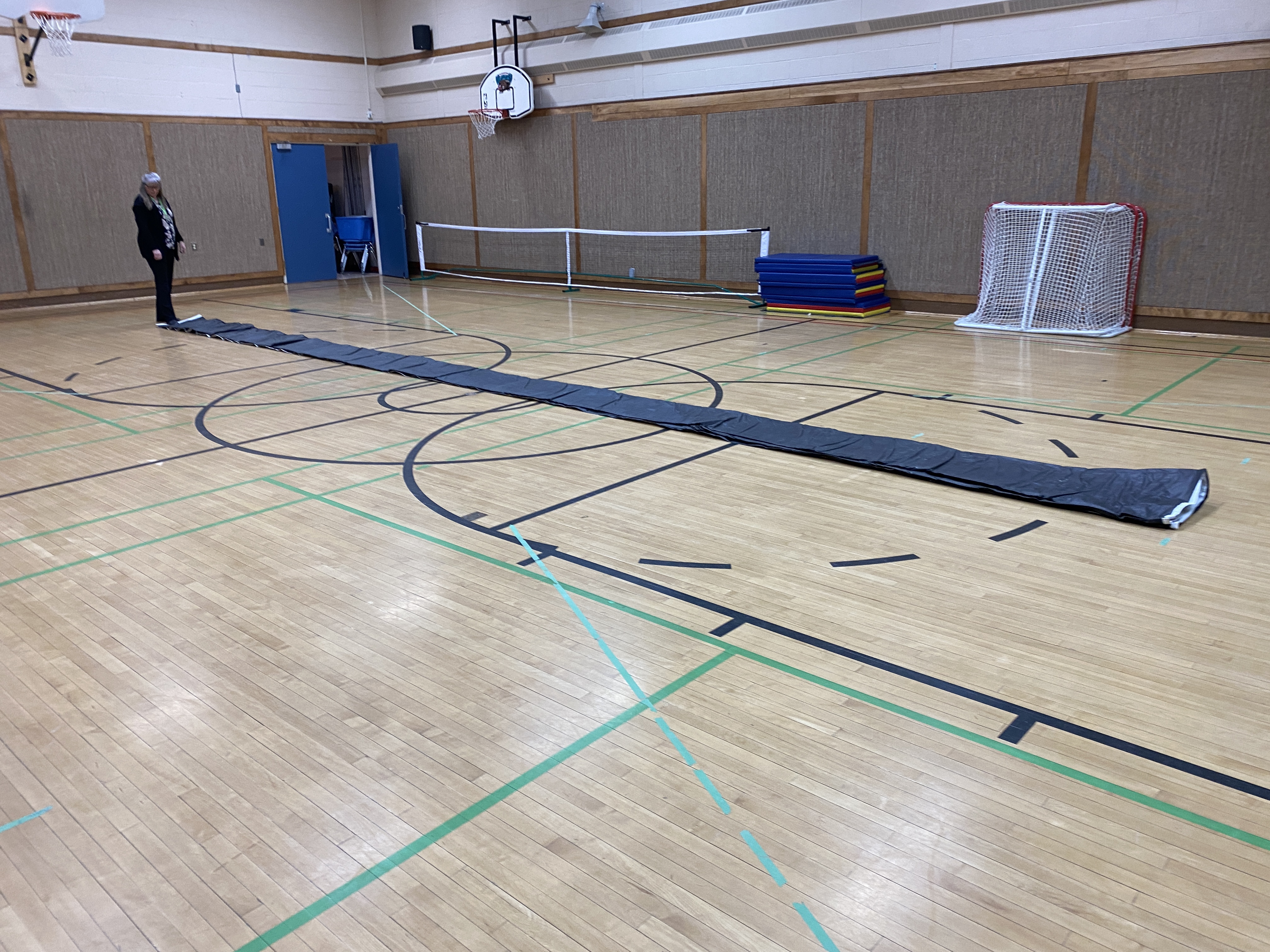
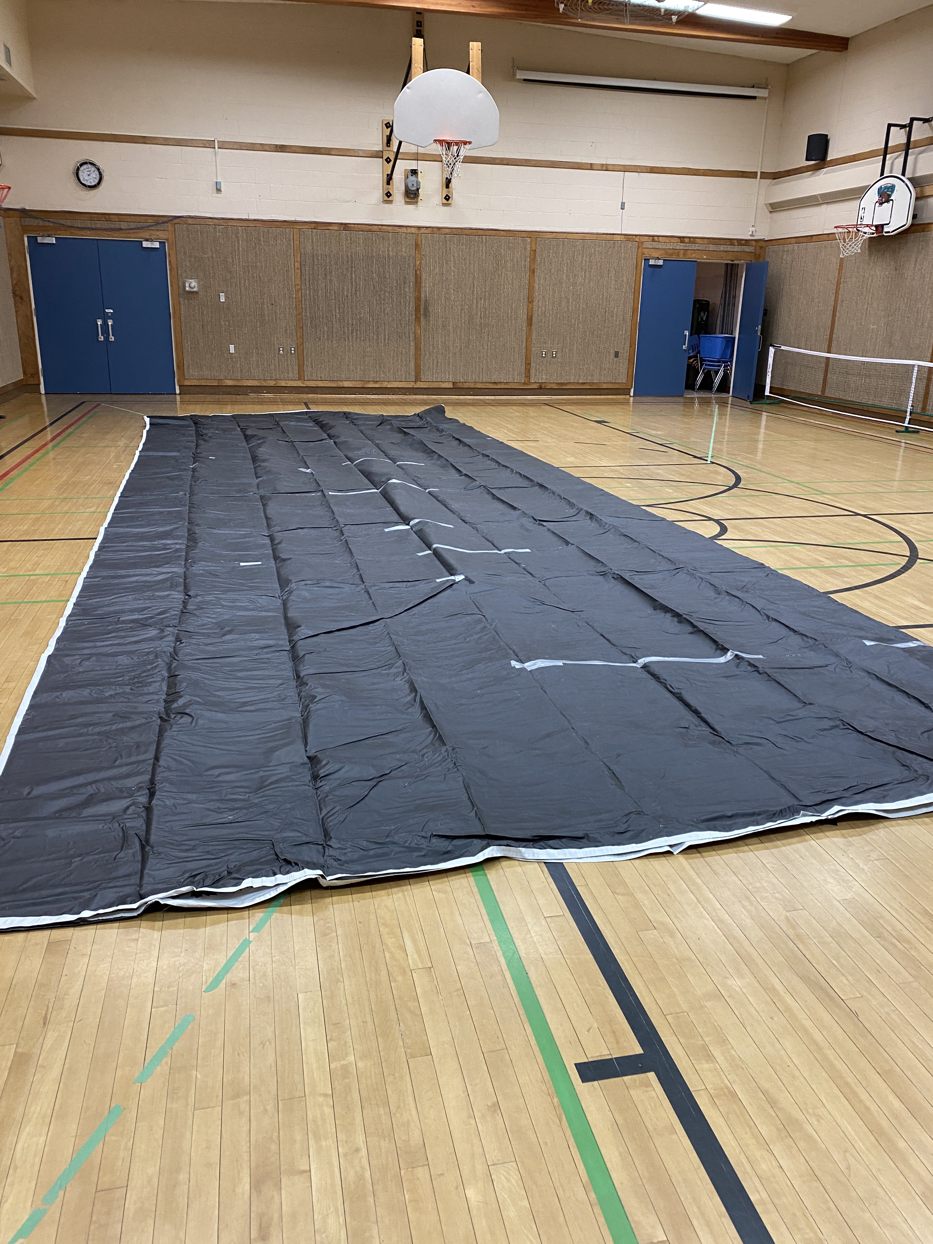
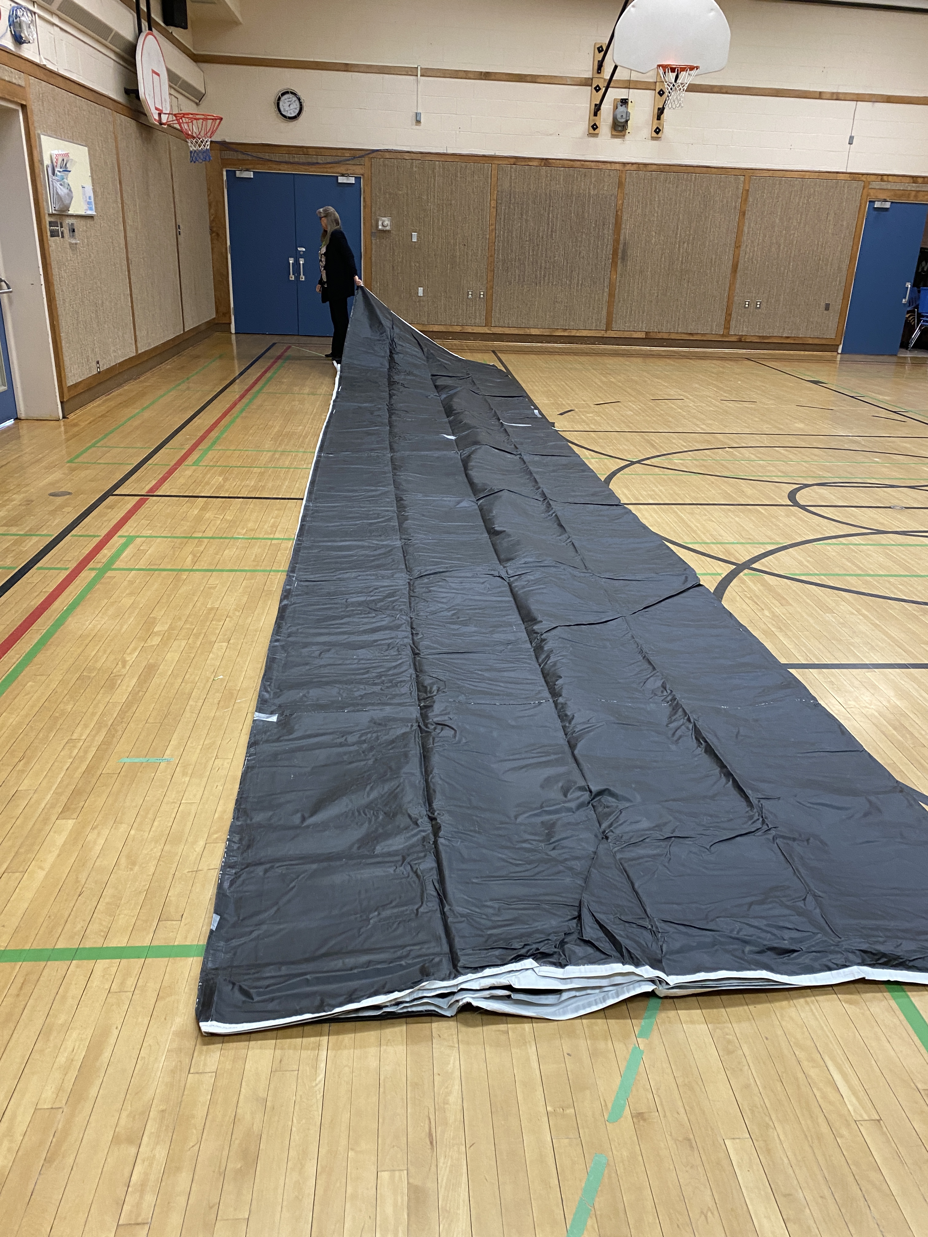
In a very appropriately Canadian way, the map travels in its own hockey bag! As you might tell from the size of the map in the images below, the bag is pretty heavy. Fortunately, it is a “wheeled” hockey bag, and I am just able to heave that thing into the trunk of my car.
Packing and unpacking is definitely a two-person job. Thanks, Mrs. H. for help with the first unveiling! And 3rd-grade student Trudy was a splendid pack-up helper.
This map is magical. Adults are certainly drawn to it. They reverently take off their shoes and immediately go searching for the locations that are important to them. And then the stories start….
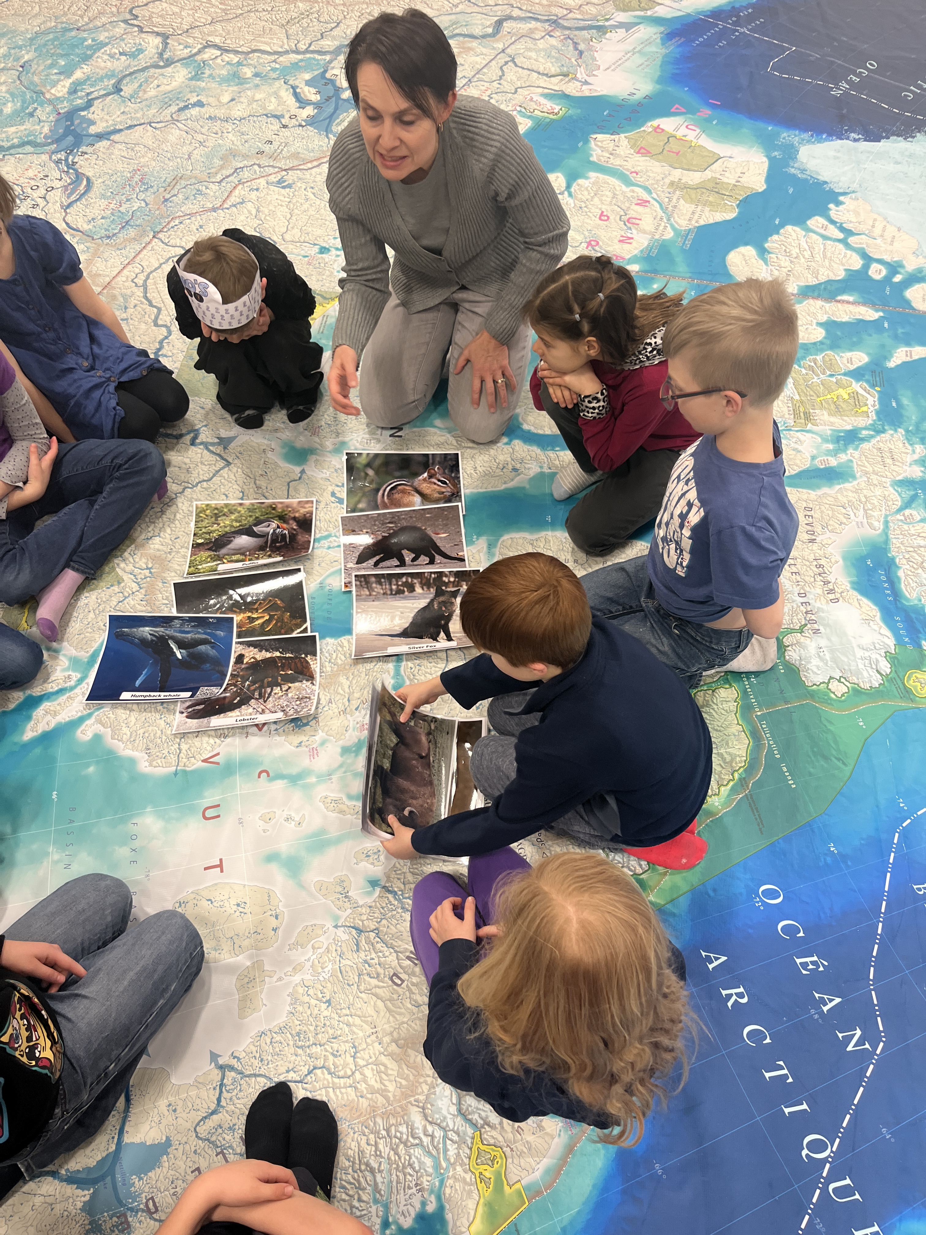
Today’s grade 2/3 group was a good one to start with. I have many, many activities planned for all ages and subjects, but my most anticipated ones are for grade 2 students. Grade two Social Studies does a comparative study of 3 Canadian communities – one on the plains of Saskatchewan, one in Nunavut, and one in New Brunswick. I created a sorting activity with beautiful pictures of wildlife from each different region. The rollout of this part of the lesson was not stellar. I will have to get better at managing where students sit or stand – close enough to be able to see necessary detail but spread out enough to see the whole map.
Fortunately, I get to try again first thing tomorrow morning with the grade two students at Foremost School. By the end of the day, I will have worked with 6 classes and tried out almost all of my lesson options! Until then…
Investigating similarities of wildlife that lives in the Arctic.
This post is part of a series that describes the learning journey of combining two great projects that focus on the hamlet of Acadia Valley, AB and the grade 4-5-6 combined class at Warren Peers School. The two intertwining projects will be 1) putting this community on the A Kids Guide to Canada MapAND 2) using our community information to build digital breakout tasks (with BreakoutEDU.com) that we will later share with parents, the school and the community. Follow the whole journey here.
Last school year, this grade 4-5-6 split class had done lots of work getting to know the ins and outs of creating breakouts – but we needed a little refresher after a long COVID break to get our “creator minds” in gear.
Principal/teacher Mrs. Fletcher Wilson gets in on the Breakout action
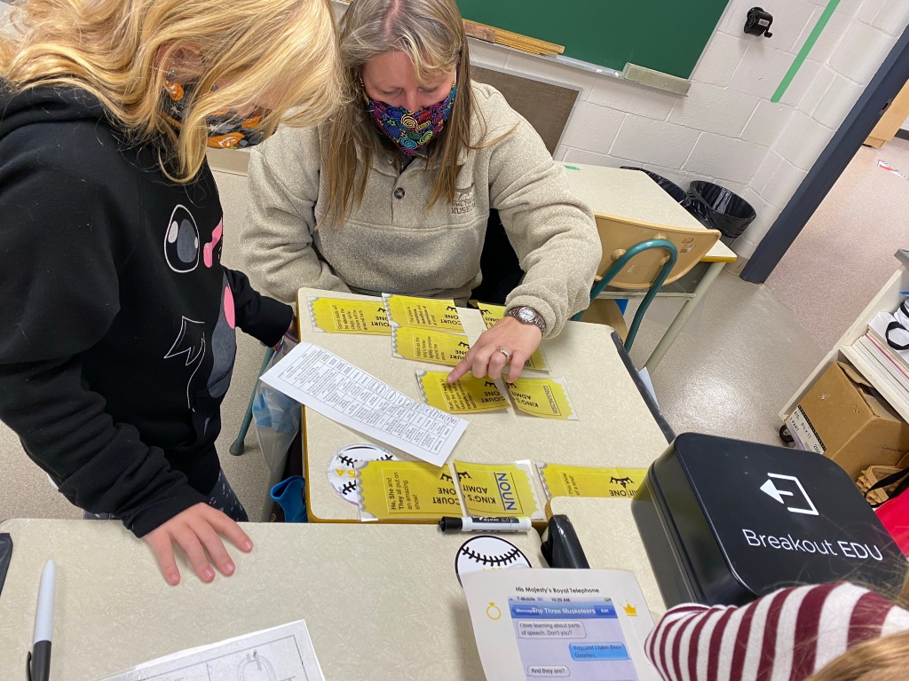
Step 1: Physical Breakout Review
Our kickoff to this combined project of Breakout building and Community discovery with the A Kids Guide to Canada MAP project was to participate in a physical Breakout game. So with masks and other COVID protocols in place for working as a group on a physical breakout, students are strategically placed in groups of 2 and are challenged to Break Out!
The Power of Yet
This breakout was a challenging, content-specific one about Parts of Speech. As I facilitate Breakout sessions with students across our district, it sure is interesting to see how students respond the first time or two in the area of grit or perseverance. So often, the students’ instinct is to give up the first time they try a lock and it doesn’t open. Many students don’t even know how to try something different, tweak their approach, or to “think outside of the box”. Thus, a big goal that I have for classes that play Breakout is to develop a “not-yet”, perseverance-driven growth mindset.
Next up: Step 2
Read about the rest of the “Ultimate Community Project” here.
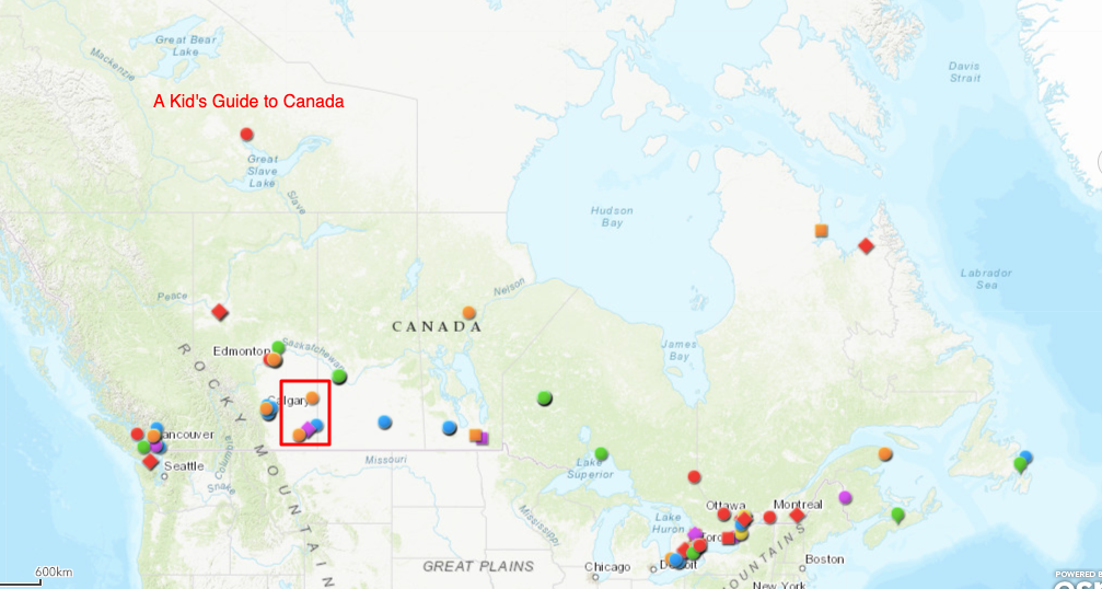
In our mostly rural school district over the past 3 years, we have helped teachers in a few different communities put their schools and communities On the Map as a project connected to A Kid’s Guide to Canada. On the map above you can see our Alberta community dots for Burdett, Redcliff, Schuler and New Brigden located inside the red box. Click this link to get to the interactive map and click on these dots found in Southern Alberta. When you click on the community, scroll down to see images and links.
Last spring we were planning to add Warren Peers School, located in Acadia Valley, AB to the A Kid’s Guide to Canada map, but then COVID hit. In addition, COVID interrupted a student digital Breakout Building project that we were working on in the triple-graded 4-5-6 class at Warren Peers. This fall, as we started to resurrect our Digital Breakout Class project, the idea to merge the Digital Breakout creation with putting Acadia Valley on the A Kid’s Guide to Canada map started to click into place.
Acadia Valley is located about 1.5 hours north of our district office, so when we travel to the community to work on a project we usually carve out several different time slots during the day to make the drive worthwhile!
This will be the launch page to read about the steps in this process and our progress. Links will be added as our project progresses. We invite you to follow along in this multi-disciplinary, multi-class, deeper-learning project.